what we want
Our Goals
Contribute extracting the best advantages of the GNSS capabilities, seen as a stand-alone or hybridized medium, beyond its conventional capacity of localisation and timing.

What we are
What is TILT?
TILT is a recent consulting company propounding Tiptop Innovating Localisation Technologies, looking for new implementations of GNSS for navigation and sensing technologies
Which Background?
Its field of expertise mainly relates the definition and design of safe, secure and robust GNSS centered localisation, sensing and authentication applications, for safety of life and critical applications, in harsh environments.
What we do
New implementations of the GNSS technologies
Based on Generalized Spatial Correlation, by performing massive correlation between the GNSS received signals and the ones predicted at the referenced positions
Localisation
New implementations of GNSS signals for Point Positioning based control and monitoring
Sensing
Looking for new usages of GNSS signals and implementations for passive sensing of the environment
Authentication
Usage of GNSS as an open mean to support authentication of data and identification
what we offer
Extended areas of application
3 new GNSS based services using the same innovant and robust processing:
“Correlation on Demand”
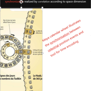
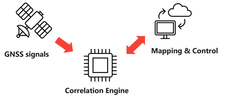
“The same Core Correlation Processor for many services & Applications”
DETECTION ON THE LOOKOUT
Focuses processing ressources on the detection of the lookout position
By anticipating the GNSS signals at the lookout position on the basis of the predicted phases of the deterministic PRN codes. This overall match filtering provides better precision and robustness on the time of passage than a standard GNSS receiver

Train
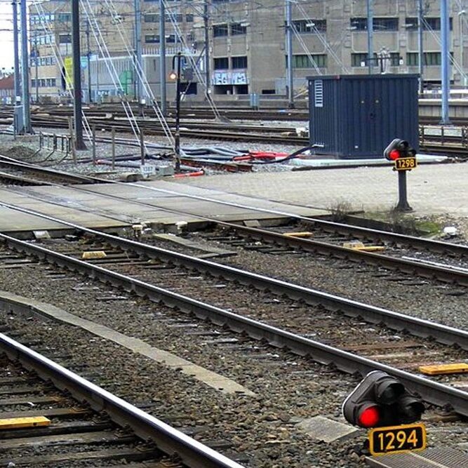
Accurate and robust Point Positioning applied as virtual balises for trains moving on tracks
Direction change detection on Rail track Switches
Safe cold start Point Positioning for parked trains/ wagons
Integrity monitoring for point positioning
Front-end obstacle detection on the track:
- Detached wagon
- Any unexpected vehicle
- landslide
Drone

Accurate and safe Geocaging/ Geofencing
Short range Obstacle Detection
Waypoint Crossing Detection
Altimeter / GNSS-R
Authentified Position and Time and identification
Data link and communication protection
Automotive

Passage detection/ control (toll)
Tachograph data cyber protections
Vehicles’ Position and Time Authentication
Vehicules Side guidance
Monitoring

Personal and goods monitoring
Emergency localization support
Proof of delivery
Low consumption long term positioning
Our work
Trademarks Portfolio
Products under development


The novelty of PaDLOok relates to the implementation of a new principle of localisation, based on satellites’ bearing, delay & doppler , being equivalent to a “Passage detection on the lookout“ (named PaDLook), still never implemented via GNSS receiver devices.
It’s purely dedicated to the detection of mobiles positions at the closest of virtual reference spots
.
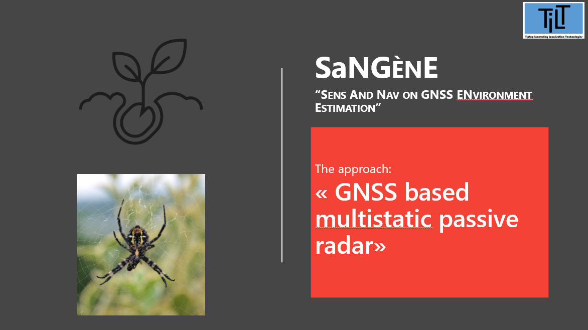

The novelty of SaNGène relates to the implementation of a new principle of obstacle detection, based on the sole GNSS signal, equivalent to a “multi-static passive radar“ (named SaNGEnE), that will be able to provide navigation and sensing capability, and never implemented in the GNSS field context.
It’s purely dedicated to the detection of short range obstacles around the vehicle or drone platform.


TRUST is an innovative solution for implementing Zero Trust Architecture in tactical defence systems, based on a new and robust authentication and encryption concept, involving precise position and time information.
TRUST solution relies on GNSS signal signature and others intermediate GNSS satellite measurements, for generating random codes and fingerprint, for encrypting the data of interest and authentifying the origin of the message
What we have
A few things we’re great at
TILT is developing, on its own, an activity of inventing new principles for the use of GNSS signals, allowing a more robust and integrated localization than that provided by classic GNSS localization methods, concretized by a first batch of 3 patent applications filed in 2022 at the INPI (publishable in 2023),
PaDLOoK Method
A method for detecting the on-board passage, without precise prior temporal and frequency synchronization between transmitters and receivers, of a mobile moving on a constrained trajectory, said method performing spatially appropriate filtering on the predicted directions of reference transmitters at the expected crossing points,
According to specific methods of implementation, the process includes:
– a treatment of the formation of directivity channels carried out by coherent integration of the received signals, after compensation of the carrier phase, corresponding to the projection of the displacement of the mobile in the direction of transmission of each reference system, assumed to be coherent phase,
– in an embodiment using GNSS signals, multi-dimensional adapted filtering involving simultaneously spatial filtering on the arrival directions of the reference signals and filtering in time and frequency, on delays and dopplers expected from the reference signals,
SanGEnE Method
A method for detecting and locating obstacles, according to the principle of passive multistatic radar, using GNSS-type signals of opportunity, performing a spatial adapted filtering in addition to the appropriate filtering in time and frequency commonly used for positioning. This spatial filtering, carried out by synthetic aperture antenna processing, is adapted to the directions of arrival of indirect signals defined according to a grid of reflection points, arranged at angles and distances near the position of the carrier.
Spatial adaptive filtering performs a sweep of the reflection directions covering the hypotheses of angles of arrival in the field of the echoes in relation to the direction of travel of the carrier. These angular directions are defined in conjunction with the delay and Doppler assumptions of the reflected indirect signals, which are established in relation to the arrival time and reception frequencies of the direct signals tracked by the receiver.
G0_TRUST Method
A method of authentication and encryption without a third party, known as spatio-temporal encryption, applied for the protection of information of interest in order to guarantee the origin and integrity of its content for the purpose of recording or transmission, based on hidden characteristics associated with the position and date of creation of the message, resulting from the processing of GNSS signals.
The method makes it possible, without additional dedicated security infrastructure, to protect and authenticate, at any place and at any time, any data inserted in the information system, and to assess, at any level of the system, the associated security risk.
Taking advantage of the different levels of access protection for GNSS signal services, the solution offers different robustness capabilities whose complexity and security can be adapted according to the level of threat, while minimizing the impact on the performance of the communication network.
MAC Method
An integrity control method associated with the Point Positioning localization by determining the closest position to a set of predefined reference positions, known as the determination of the position on the lookout, for implementation on a mobile or fixed carrier, said method for verifying that the correlation function of the received GNSS signals is consistent with the selected reference position, in accordance with a protective radius and a risk of loss of integrity required for the safety of the positioning system.
The effectiveness of this position integrity check is determined by its protection radius, which represents its ability to detect defects that are likely to result in position errors at least equal to this radius, for the risks of non-detection and false alarm, and the required alarm times.
The advantage of testing the adequacy of a hypothetical position with the correlation function of the received signals is that it allows each one to check whether or not it is in the vicinity of a maximum of the spatial correlation function.
A few things we’re great at
TILT awarded by EUSPA

GNSS Passive Radar:
A Solution of the Future Imagined by TILT Consulting and Supported by M3 SYSTEMS (which was awarded by EUSPA!)
On Wednesday, June 1st , 2022, M3 Systems and TilT Consulting were declared winners for their breakthrough solution of passive radar for detection and localization of obstacles, based solely on GNSS signals. This is a project which was submitted in the context of the Move Me Smart category of the international call for ideas in the My EUSPA Competition 2021. This project was organized by the European Union Agency for the Space Program (EUPSA) for the realization of the concept (TRL<4)
A few things we’re great at….
… and Pre-selected by EDA
Defense innovation price 2023

“In relation to your application TRUST to the EDA Defence Innovation Prize 2023, we are pleased to inform you that it has arrived at the step 3 of the Incremental Evaluation Procedure, following the criteria specified in the Rules of Contest – Section 2.7.4/5.”
Proposals over a quality threshold to be set by the evaluation committee (including the winners) will be presented to the CapTechs Moderators in a dedicated workshop to explore the applicability of their proposals to the CapTech’s areas of responsibility
